

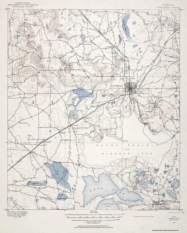
Some 50 years ago, or more, I happened to be in Mike’s Bookstore in downtown Gainesville one evening. I recall seeing a map cabinet with maps for sale. I picked one out, paid for it, and then it languished in a cardboard tube for many years. At some point I had it framed and it’s resided on my office wall for more years than I care to remember.
Recently, there was a post in the Vintage Gainesville Facebook group about Ft. Clarke and what and where it might have been. The photo that accompanied the post was of the historical marker that stands outside Ft. Clarke United Methodist Church at the intersection of Newberry Road and NW 91st Street.
I commented that if you go south on 91st Street for maybe a hundred yards and look to the left, you can see a depression in the midst of a bank of azaleas. Dozens of years ago, before there was a wire fence to negotiate, I walked that area and realized it’s a section of the Bellamy Road that ran more or less north to south a couple of centuries ago. Originally, it was the principal north-south route through central Florida. Locally it ran from Alachua in the north to Micanopy and beyond in the south.
On the 1890 map you can clearly see evidence of a road that runs NNE (north north east) from Newberry Road and continuing SSE through Arredondo toward Micanopy. That direction and location conforms to the depression you should still be able to see in the front yard of one of those houses not far south of Newberry Road.
If you Google the title of this post, you’ll be able to buy your own copy of the map from Amazon. It’s a fun map to explore and match up with what you see on the ground today.
